When students look at the political map of India, they often notice that Sri Lanka, although an independent country, is shown very close to India. In physical maps, cultural maps, and even some regional maps, Sri Lanka appears either highlighted near the southern tip of India or marked within the same frame. This sometimes creates confusion among students who wonder why a separate nation is displayed on India’s map.
Actually, Sri Lanka is not shown as part of India, but it is shown along with India because of geographical closeness, historical ties, cultural links, and regional importance. Including Sri Lanka in India’s map helps students understand the subcontinent better. Let’s explore the reasons in detail.
1. Because Sri Lanka Lies Very Close to India Geographically
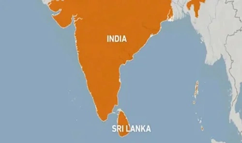
Sri Lanka is located just below India in the Indian Ocean. The shortest distance between the two countries is only approximately 30 kilometers across the Palk Strait.
Because of this closeness:
- Both countries appear together in most maps.
- It becomes easier to show landforms such as the Palk Strait, the Gulf of Mannar, and the Indian Ocean.
- Students get a clear understanding of India’s southern geography.
A map is meant to display physical and political features clearly. Leaving out Sri Lanka would make the southern part of the map look incomplete.
2. To Show Important Water Bodies
Between India and Sri Lanka lie important water bodies like:
- Palk Strait
- Palk Bay
- Gulf of Mannar
- Indian Ocean
These water features are crucial for understanding India’s geography, climate, monsoons, fisheries, and maritime routes. If Sri Lanka were not shown in the map, students would not be able to see the connection between these water bodies and the Indian coastline.
Showing Sri Lanka helps in:
- Understanding ocean currents
- Studying monsoon winds
- Learning about marine biodiversity
- Understanding India’s maritime boundaries
Thus, both countries appear together for better geographic clarity.
3. Because India and Sri Lanka Share Historical and Cultural Connections
India and Sri Lanka have a deep historical relationship dating back thousands of years. They are often discussed together in subjects like history, culture, and religion.
Some famous cultural links include:
- Ramayana, where Sri Lanka plays a central role
- Spread of Buddhism from India to Sri Lanka
- Ancient trade routes between Tamil kingdoms and Sri Lankan rulers
When maps include Sri Lanka along with India, it supports classroom teaching and helps students understand these shared cultural links visually.
4. To Show India’s Neighborhood and Foreign Relations
In political science and social studies, students learn about India’s neighboring countries. Sri Lanka is one of India’s closest neighbors. For this reason, it must be shown in regional maps.
Including Sri Lanka helps explain:
- India’s foreign policy
- SAARC countries
- India’s role in the Indian Ocean Region
- Trade and security relations
Students get a clearer picture of India’s strategic position when neighboring countries are shown on the map.
5. To Understand the Island’s Location in the Indian Subcontinent
Maps often display entire regions such as:
- The Indian subcontinent
- South Asia
- The Indian Ocean Region
Sri Lanka is an important part of all these regions. Showing Sri Lanka helps students understand:
- How the Indian subcontinent is shaped
- How islands and peninsulas are placed
- Why the Indian Ocean gets its name
Without Sri Lanka, the southern representation of the subcontinent would look incomplete.
6. Important for Trade, Navigation, and Maritime Studies
Sri Lanka is shown on India’s map because the island plays a major role in:
- Indian Ocean trade
- Shipping routes
- Strategic naval positioning
Major ports like Colombo and Hambantota are close to India. Displaying Sri Lanka on maps helps explain why the region is important for India’s economy, defense, and international shipping.
7. Educational Maps Always Show Neighboring Countries Together
In school textbooks, maps are not just for showing borders—they are for teaching relationships between countries. For example:
- Pakistan and Afghanistan are shown near India in the north-west
- Nepal, Bhutan, and China are shown in the north
- Bangladesh and Myanmar are shown in the east
- Similarly, Sri Lanka is shown in the south
This helps children understand the full geographical context of India’s location in Asia.
Conclusion
Sri Lanka is shown in the India map not because it is part of India, but because it is geographically close, historically connected, and regionally important. Including Sri Lanka helps students understand India’s southern landscape, maritime boundaries, cultural ties, and neighborhood relations more clearly. Maps are tools of learning, and showing nearby countries together helps create a complete and accurate understanding of India’s place in the world.